 |
| Tonight I was in San Diego as part of a trip to the area to visit my friend Jannine in the hospital (and throw in a little vacation in the process). A mutual friend of our's named Jon Marsh with whom we grew up joined us (Jannine's mom Patsy who is also my friend) for a small concert at The Merrow in the Hillcrest District of San Diego. The concert featured several local bands the best of which was one led by a mutual friend of Jannine, Jon, and I (we all grew up together in Atascadero and were Class of 1989) named Mike Mariotti. Mike is the frontman of Mojave Green and they brought down the house to the degree it could be considering the place was not packed. This photo was captured with my iPhone 3 so it is what it is quality-wise. Image by Kim Patrick Noyes (all rights reserved). |
Saturday, August 29, 2015
Picture of the Day - Snakebitten by Mojave Green
Wednesday, August 26, 2015
The Four Best Cuesta Fire Images
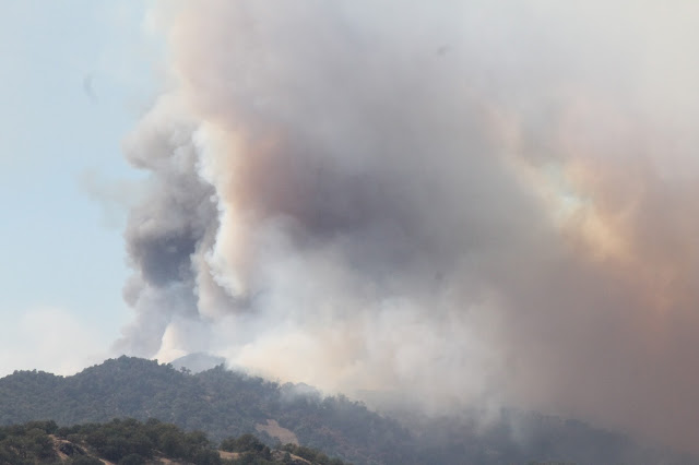
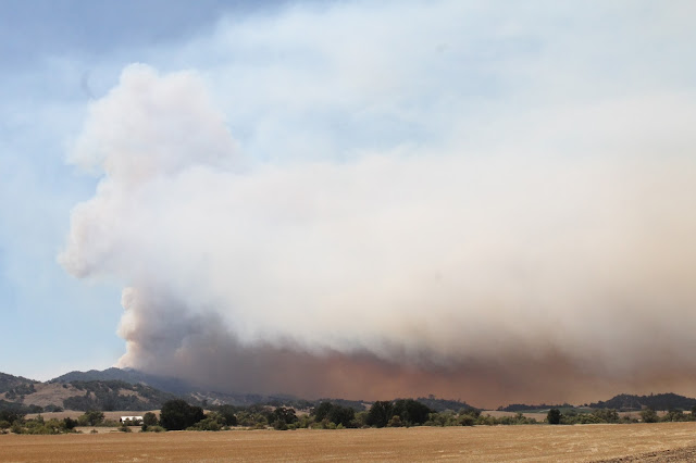
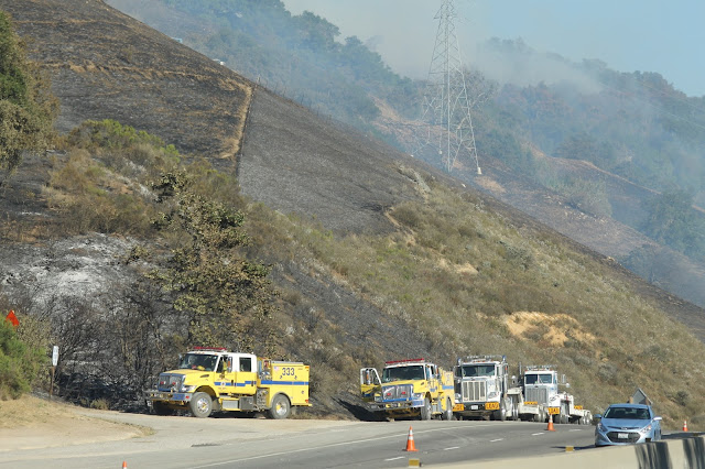
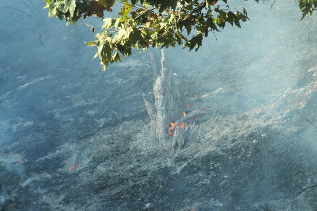
With the 2,446 acre Cuesta Fire now effectively out and nearly contained and following a week of my priorities and attention being focused elsewhere I want to return to that fire on this blog and give it a bit of a farewell send-off with a posting of what I feel are the best images captured of the event per my perusal of Twitter.
 |
| This image was captured by Brady Cabe on the night of August 17, 2015 or Night Two of the fire. |
 |
| This image was captured by Erick Rickorian on the night of August 16, 2015, or Night One of the fire. |
 |
| This image was captured by Julie NoName on the night of August 17, 2015, or Night Two of the fire. |
 |
| This image was captured by Nick Tyree on the night of August 17, 2015, or Night Two of the fire. All image courtesy of their respective photographers (all rights reserved). |
Wednesday, August 19, 2015
Picture of the Day - Cuesta Fire Fourth Day
 |
| This was the scene today from Pozo Road just outside of Santa Margarita showing the 3,500-acre Cuesta Fire raging in the Santa Lucia Mountains to the south of town and east of San Luis Obispo, CA. Photo by Kim Patrick Noyes (all rights reserved). |
Tuesday, August 18, 2015
Cuesta Fire - Day Three
Today I drove down to see the 2500-acre Cuesta Fire once again with mom. She drove and I rode along so I could snap some images. We took Highway 101 down to Monterey Street in San Luis Obispo and turned around and came back up the grade. It was still interesting on that side today, but much less is going on as most firefighting apparatus and resources that were there yesterday have moved on and there were no visible flames.
On the Santa Margarita side of the Santa Lucia Mountains (we pulled off of the 101 and onto Highway 58) it was a different story. There was much activity as fire and law enforcement personnel (there to help with evacuations and protecting vacant properties) coming and going. We headed out of town on Highway 58 and proceeded out into the Rinconada Valley on Pozo Road and saw some fairly interesting smoke activity and fire activity from a distance sans any visible flames due to terrain and smoke obscuring our view. The following images are shown in the order I captured them.
*Note: some of my images again today feature an annoying flaw much like yesterday. I have a scratched lens and thought it was caused by that. Tonight while looking inside my camera I realized it was a speck of lint which I have now removed. Subsequent images should be clean of artifacts.
 |
| Southbound US 101 just north of Santa Margarita, CA. |
 |
| Left flank of the fire stuck in retardant on a ridge of oak woodland overlooking US 101. |
 |
| Retardant-stained ridgeline adjacent to the northbound side of US 101 just west of Santa Margarita. |
 |
| Two strike teams of CALFIRE type-3 engines from Monte Vista Unit (San Diego County) staged at the summit of the Cuesta Grade. |
 |
| Sudden flare-up as viewed from San Luis Obispo at Monterey Steet. |
 |
| Flare-up just over the ridgeline from the Cuesta Grade with Mt. Lowe Road crossing the face of the slope. |
 |
| Only one USFS type-3 engine from the Los Padres NF kept an eye out on the grade now that fire activity was minimal to none. |
 |
| Retardant-stained hillside. |
 |
| A Bell Huey copter on the Santa Margarita side of the Cuesta Grade. |
 |
| The aforementioned two strikes teams from San Diego County stated at the top of the Cuesta Grade. |
 |
| Another Bell Huey helicopter utilizing a bambi bucket. |
 |
| Air Attack 410 out of Porterville was the only fixed-wing aircraft over the fire during the time we were at the fire. The aircraft is dwarfed by the smoke plume and barely visible here. |
 |
| I cut off the nose of the OC bird (another Bell Huey) |
 |
| The smoke here had an odd glow to it that reflected off of Pozo Road here. |
 |
| Pozo Road in the Rinconada Valley looking back to the west at the fire. |
 |
| This area last burned variously in the 1985 Las Pilitas Fire and 1994 Highway 41 Fire. |
 |
| This fire is burning close to where I worked last weekend at Oyster Ridge Ranch near the zip line adventure site. |
 |
| Smoke obscured our seeing any flames. |
 |
| This flare-up resulted from a wind change that blasted by us briefly as we watched the fire from Pozo Road. |
 |
| All photos by Kim Patrick Noyes (all rights reserved). |
Monday, August 17, 2015
Cuesta Fire - Day Two -Trip Two
This afternoon my mother and I (with me riding shotgun in her car) drove down to see the nearby 2000-acre Cuesta Fire burning in the Cuesta Grade area of the local stretch of the Santa Lucia Range in the Los Padres National Forest. The fire flared up this afternoon from the afternoon winds that firefighters feared would come. The result was the fire spotted over the ridgeline east of Highway 101 and uphill from it and fully implaced itself within the national forest after starting in State Responsibility Area (SRA).
Once we got word of the escape we rushed down from my house in Paso Robles. Actually, we drove down to view the fire twice today separated by a short break at her home in Atascadero. Both times we took the 101 Freeway down to San Luis Obispo and turned around at Monterey Street and returned in the bumper-to-bumper traffic headed up the Cuesta Grade. This slowness allowed us to get a great view of it without stopping along the route to take pictures which the CHP was discouraging by way of sentinel units holding watch along the length of the grade. From there we pulled off the freeway at Highway 58 and headed into Santa Margarita to check on fire preparations there as the fire approached.
What follows are images I captured as a passenger in a car shown in the order I took them. I am dividing up the two trips today into two separate blog posts but I am linking them together for easy reference. See Cuesta Fire - Day Two - Trip One.
Note: one of the lenses I use with my camera has a noticeable scratch which shows up on some images. I cannot currently afford to replace it so please bare with my flawed images until then.
 |
| By now it was clear the fire was fully-established over the hill to the east of the ridgeline from the Cuesta Grade. |
 |
| Two Ventura Co. FD type-3 engines were now parked in front of the Kern Co. dozer transports at the top of the ground on the northbound side of the highway. |
 |
| Several smokes within the burn area threatened to flare up at any moment. |
 |
| CALFIRE battalion chief at left and LPF (Los Padres National Forest) engine at right. |
 |
| The CALFIRE Miramonte crew strike team itself was still nowhere to be seen. |
 |
| Oh, there they are way up near the top of the main ridgeline supported by an LPF engine, a water tender and a CALFIRE battallion chief. |
 |
| That painted red spur ridge again. |
 |
| Speaking of painted, here's a retardant-painted CALFIRE FKU (Fresno-King Unit) engine strike team leader. |
 |
| A different retardant-painted hillside. |
 |
| Open flames in grass. |
 |
| Open flames in underbrush. |
 |
| Miramonte Conservation Camp crew bus from CALFIRE TUU (Tulare Unit). |
 |
| The looky-loo parking patrol. |
 |
| Smouldering stump still alight. |
 |
| Same stump, but closer. |
 |
| The aforementioned Kern County dozer strike team brought themselves an off-road buggy, too. |
 |
| The aforementioned Ventura Co. FD type-3 engines. |
 |
| CALFIRE Copter 406 flying over Highway 101 |
 |
| CALFIRE Copter 901 lifting out of pond adjacent to northbound side of Highway 101 between Cuesta Grade and Santa Margarita. |
 |
| Bambi bucket used by Copter 901 |
 |
| A strike team of Los Angeles County fire crew buses staged at park & ride at Highway 58 and Highway 101 intersection. |
 |
| BEU (San Benito-Monterey Unit CALFIRE) dozer transport at left with private dozer to the right of it headed into Santa Margarita. |
 |
| The heli-tender for Copter 106 driving through Santa Margarita. |
 |
| Copper-colored sun as viewed through the smoke southeast of Santa Margarita, CA. All photos by Kim Patrick Noyes (all rights reserved). |
Subscribe to:
Comments (Atom)

