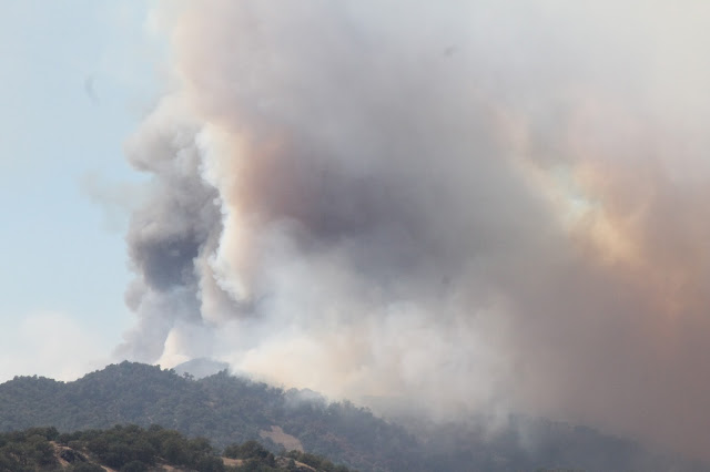
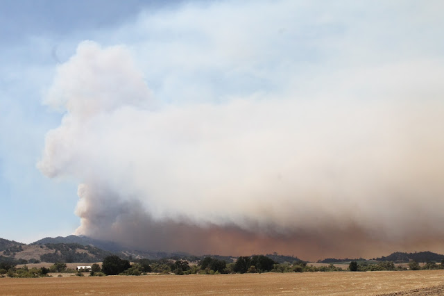
On the Santa Margarita side of the Santa Lucia Mountains (we pulled off of the 101 and onto Highway 58) it was a different story. There was much activity as fire and law enforcement personnel (there to help with evacuations and protecting vacant properties) coming and going. We headed out of town on Highway 58 and proceeded out into the Rinconada Valley on Pozo Road and saw some fairly interesting smoke activity and fire activity from a distance sans any visible flames due to terrain and smoke obscuring our view. The following images are shown in the order I captured them.
*Note: some of my images again today feature an annoying flaw much like yesterday. I have a scratched lens and thought it was caused by that. Tonight while looking inside my camera I realized it was a speck of lint which I have now removed. Subsequent images should be clean of artifacts.
 |
| Southbound US 101 just north of Santa Margarita, CA. |
 |
| Left flank of the fire stuck in retardant on a ridge of oak woodland overlooking US 101. |
 |
| Retardant-stained ridgeline adjacent to the northbound side of US 101 just west of Santa Margarita. |
 |
| Two strike teams of CALFIRE type-3 engines from Monte Vista Unit (San Diego County) staged at the summit of the Cuesta Grade. |
 |
| Sudden flare-up as viewed from San Luis Obispo at Monterey Steet. |
 |
| Flare-up just over the ridgeline from the Cuesta Grade with Mt. Lowe Road crossing the face of the slope. |
 |
| Only one USFS type-3 engine from the Los Padres NF kept an eye out on the grade now that fire activity was minimal to none. |
 |
| Retardant-stained hillside. |
 |
| A Bell Huey copter on the Santa Margarita side of the Cuesta Grade. |
 |
| The aforementioned two strikes teams from San Diego County stated at the top of the Cuesta Grade. |
 |
| Another Bell Huey helicopter utilizing a bambi bucket. |
 |
| Air Attack 410 out of Porterville was the only fixed-wing aircraft over the fire during the time we were at the fire. The aircraft is dwarfed by the smoke plume and barely visible here. |
 |
| I cut off the nose of the OC bird (another Bell Huey) |
 |
| The smoke here had an odd glow to it that reflected off of Pozo Road here. |
 |
| Pozo Road in the Rinconada Valley looking back to the west at the fire. |
 |
| This area last burned variously in the 1985 Las Pilitas Fire and 1994 Highway 41 Fire. |
 |
| This fire is burning close to where I worked last weekend at Oyster Ridge Ranch near the zip line adventure site. |
 |
| Smoke obscured our seeing any flames. |
 |
| This flare-up resulted from a wind change that blasted by us briefly as we watched the fire from Pozo Road. |
 |
| All photos by Kim Patrick Noyes (all rights reserved). |

No comments:
Post a Comment