

Showing posts with label thunderstorms. Show all posts
Showing posts with label thunderstorms. Show all posts
Sunday, June 2, 2019
Quite The Electrical Show!
Saturday, May 25, 2019
Shasta County LP Supercell Redux
Upon further search of Twitter I found some more amazing images of the low precipitation supercell thunderstorm that appeared over the skies of Shasta County in the Redding, CA area. I commend these photographers for capturing so well such mystery and beauty. View more such images in yesterday's blog post HERE.
 |
| Photo courtesy of Angela Walfoort (all rights reserved). |
 |
| Photo courtesy of Angela Walfoort (all rights reserved). |
 |
| Photo courtesy of Angela Walpoort (all rights reserved) |
 |
| Photo courtesy of Denis Lincoln (all rights reserved). |
 |
| Photo courtesy of Derek Taft (all rights reserved) |
 |
| Photo courtesy of Marisa Earlywine (all rights reserved). |
 |
| Photo courtesy of Tehama Co. Spotter (all rights reserved). |
 |
| Photo courtesy of Johnette and Jay @Sigrid_39 (all rights reserved). |
 |
| Photo courtesy of Monica Leard (all rights reserved). |
Friday, May 24, 2019
Shasta County LP Supercell
Earlier this evening, a rare event struck Shasta County in the Redding, CA, area. A low precipitation (LP) super-cell formed and put on a dramatic show, triggering a radar-detected tornado warning, and dumped very large hail in some places. Below are my favorite images. See more such images in tomorrow's blog post HERE.
*NOTE: this very community was assaulted last summer by a large, dangerous fire tornado from the Carr Fire.

Photo courtesy of Michelle Teasley (all rights reserved).

Photo courtesy of RottenGOP on Twitter (all rights reserved).

Photo courtesy of Mike Chapman (all rights reserved).

Photo by Monica Leard (all rights reserved).

Photo by Drew Tuma (all rights reserved).


Photo by Steve Laymon (all rights reserved).

Photo by Maureen Bonessa (all rights reserved).

Photo courtesy of Sandy Trent (all rights reserved).
*NOTE: this very community was assaulted last summer by a large, dangerous fire tornado from the Carr Fire.


Tuesday, May 21, 2019
Graphic of the Day - Lightning Types

Sunday, April 2, 2017
Lovely Lonely Lullaby II
Thursday, March 23, 2017
Graphic of the Day - 2614 Lightning Strikes

Wednesday, March 22, 2017
Thunderstorm Over Mount Wilson


Sunday, January 8, 2017
About Last Night's Bow Echo
Last night saw the Central Coast visited by an unusual phenomenon for this area of the world, to wit, a bow echo complex of thunderstorms. These are more common in Tornado Alley and the Eastern U.S. This bow echo formed west of the Santa Barbara Channel and moved eastward through the channel and into coastal Ventura County where it made landfall. To my knowledge there were no reports of water spouts over the channel or tornados over coast valleys although they can occur with bow echos. There might have been some straight-line wind damage and minor flooding along the Gaviota Coast of Santa Barbara County but I cannot confirm that at this time. This bow echo passed south of me, but I did directly experience a more powerful bow echo in Liberal, Kansas, in 1993.
 |
| Courtesy of Jordan Root @ AccuWeather via Twitter (all rights reserved) |
 |
| Courtesy of Jordan Root @ AccuWeather via Twitter (all rights reserved) |
 |
| Courtesy of Kevin Takumi @ KTTV-TV Los Angeles via Twitter (all rights reserved) |
Sunday, December 18, 2016
Picture of the Day - Haboob Under Cumulonimbus

Monday, October 24, 2016
Picture of the Day - Ominous Yet Beautiful

Thursday, May 5, 2016
Picture of the Day - Wasco Cloud Crawler
 |
| Tonight thunderstorms are effecting various localities scattered throughout California as a cutoff low meanders over the region. The most intense activity has been centered in the San Joaquin Valley and Sierra Foothills. Jared Isaac of Shafter, CA, captured this beautiful and dramatic image north of Wasco, CA, a few hours ago. This "cloud crawler" lightning is something one would expect to see in association with the more violent thunderstorms seen in the central and eastern U.S. Photo by Jared Isaac (all rights reserved). |
Wednesday, April 27, 2016
Picture of the Day - Late Season Dying T-Storm
 |
| This storm looked delightfully dramatic from Atascadero where I was during the storm's peak including some fantastic mammatus clouds as well as a spectacular anvil cloud and an ominously dark cloud base. Great storm structure! Unfortunately, I was unable to take a photo of it during its peak intensity. However, on my way home I did manage to snap this image of it nearing its death east of Paso Robles. Earlier at its peak, it caused flash flooding near San Ardo in southern Monterey County and other such problems as it dumped prodigious rainfall along its track. Photo by Kim Patrick Noyes (all rights reserved). |
Saturday, January 9, 2016
Backtracking From A Flash Flood
This was the scene on Highway 23 in Ventura County between Fillmore, CA, and Moorpark, CA, this past Wednesday as a thunderstorm passed over the area. It reveals the second half of the fire-flood cycle that is so prevalent here in California. This thunderstorm was part of a large storm system that was one in a series this week that had a distinctly El Niño characteristic.
Wednesday, January 6, 2016
My Crazy California Morning
Weird morning to start the day.... I woke up in Paso Robles to the sounds of loud rain and thunder and vivid lightning which freaked out cat and dog.... a check of Twitter revealed that a house had caught fire in nearby Atascadero due to being struck by lightning and a modular home with a woman inside it was flipped by a weak tornado on the east side of town this a.m. .... then as I left Paso Robles on Spring Street southbound towards US101 riding with my carpool driver (my friend Blake), I noticed an unmarked constable SUV with front hidden lights all lit up headed back to the police station, the driver having forgotten his lights were still on.... my carpool driver had seen him and another constabulary unit searching a car over by the Arco Station on Niblick Road en route to pick me up.... on the south side of the Cuesta Grade en route to Cal Poly we, encountered the aftermath of an apparent police chase with about eight constabulary autos, a fire truck, and an ambulance all parked behind it, but some distance away from a car that had driven northbound off the highway and up a hill a short distance. It turns out the car contained a woman driver threatening to harm herself and which standoff lasted most of the morning.... we arrived on campus to no buses running and a Cal Poly text alert informing us that a bomb threat shut down all San Luis Obispo bus service and we learned later it was a Cal Poly student who prompted it as the bus entered the campus while packed with student en route to class.... then during the second half of my first class which runs from 10 a.m. to 12 p.m., a raging thunderstorm swept over campus with torrential rains, high winds, and pounding thunder all three of which I could hear (as well as a girl's shriek at one point) from inside my classroom down in the bowels of the PAC (Performing Arts Center).... fortunately, the afternoon and evening today were much more sedate.
Saturday, December 26, 2015
Nocturnal Texas Tornado
Today there was yet another unseasonable tornado outbreak in the eastern U.S., this time in the Dallas Metroplex. Worst hit were Garland, TX, and Rowlett, TX. I am familiar with both communities having driven through or near them in April, 2002. Eleven* people were killed this afternoon into this evening in these communities and environs. My mother's mother's family comes from Rockwall, TX, which was just east of Rowlett, TX. Below are some dramatic images taken variously from Rockwall or Rowlett, TX, and environs, generally looking west and south. Tornadoes at night are the most dangerous type. Also, it is noteworthy that this was a long-track supercell thunderstorm unusual for any time of year let alone the day after Christmas.
*Updated 12/27/15 at 9:10 p.m.
*Updated 12/27/15 at 9:10 p.m.
 |
| Rowlett, TX, tornado. Photo by Kathy Turner (all rights reserved). |
 |
| City of Rowlett, TX, water tower + tornado + lightning bolt. Photo by Ian Bentley (all rights reserved). |
 |
| This image is taken from Lake Ray Hubbard on the Rockwall, TX, side (east side) looking west over the lake at West Rockwall and Rowlett, TX, as tornado translates left to right across the field of view of this image. Note traffic traversing highway at right which crosses the lake surface. Note power flashes behind tornado. Photo credit unknown (all rights reserved). |
Tuesday, November 10, 2015
Picture of the Day - Double La-La Land Lightening
 |
| This is perhaps the most sublime image of lightening over Los Angeles that my eyes have ever beheld. I am guessing this is from the recent storm that passed through that area in recent days. Photo by Emeric Le Bars (all rights reserved). |
Wednesday, July 29, 2015
I Never Feel Alone With This Song
Sunday, March 1, 2015
Tres Storm Pics
Today's weather over the Central Coast and much of California was unsettled. Below are three images I captured today despite all I have going on in my life.
 |
| Rapidly-building thunderstorm's clouds base looming over Atascadero around the time of first lightening strike. |
 |
| View from my house in Paso Robles, CA, looking east at sunset. |
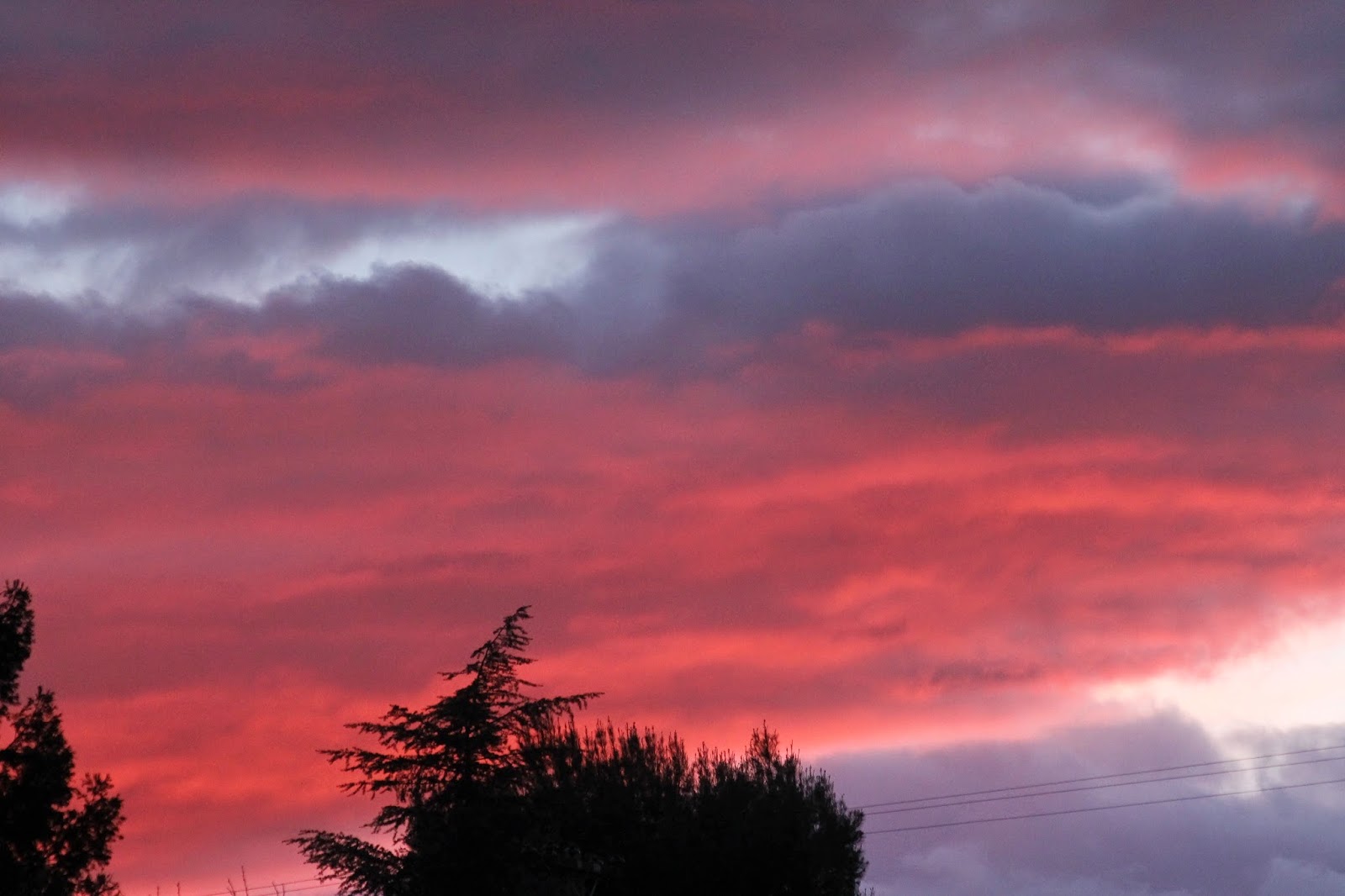 |
| View looking west from the street in front of my house. All photos by Kim Patrick Noyes (all rights reserved). |
Tuesday, January 13, 2015
Stormscapes2 Is #1
This is the coolest thing I have watched thus far this year.... albeit a mere 13 days into the year. It is also the most amazing collection of weather footage (in a mere 7 minutes) I have ever observed in my entire life. Fortunately, it also comes with an appropriate ambient musical accompaniment. We encountered the original Stormscapes last year and immediately fell in love with it but this sequel surpasses it.
Friday, December 12, 2014
A Tale Of Two T-Storm Pics
I visited the 911 Supply House in Paso Robles this afternoon. I did some Christmas shopping there AND talked to the co-owner Jim Fritsche who founded and directs the North San Luis Obispo County CERT of which I am a member. We talked about a great many things and by the time I left to head home the weather had dramatically changed outside. This dying storm cell on the backside of the huge Pacific storm which passed through last night was incredible in both storm structure and color. Combined with the perfect angle of setting sun through a rain-washed atmosphere it was like nothing I remember seeing heretofor in the North County.
I usually take my camera with me everywhere I go but neglected to do so on this outing which undoubtedly was the reason this scene unfolded when and where it did. Jim captured the scene in the top-most image below and shared it with us. I captured the image below it on my cell phone a short time later on my walk home as I rushed (too late) to get back to my house (and camera). The glow-glare from this cloud complex turned everything a surreal peach color which dramatically greeted me when I stepped out the door to leave.
I usually take my camera with me everywhere I go but neglected to do so on this outing which undoubtedly was the reason this scene unfolded when and where it did. Jim captured the scene in the top-most image below and shared it with us. I captured the image below it on my cell phone a short time later on my walk home as I rushed (too late) to get back to my house (and camera). The glow-glare from this cloud complex turned everything a surreal peach color which dramatically greeted me when I stepped out the door to leave.
 |
| Photo by Jim Fritsche (all rights reserved). |
.JPG) |
| Photo by Kim Patrick Noyes (all rights reserved) |
Subscribe to:
Posts (Atom)